Qualitative Results
Visual Demonstrations
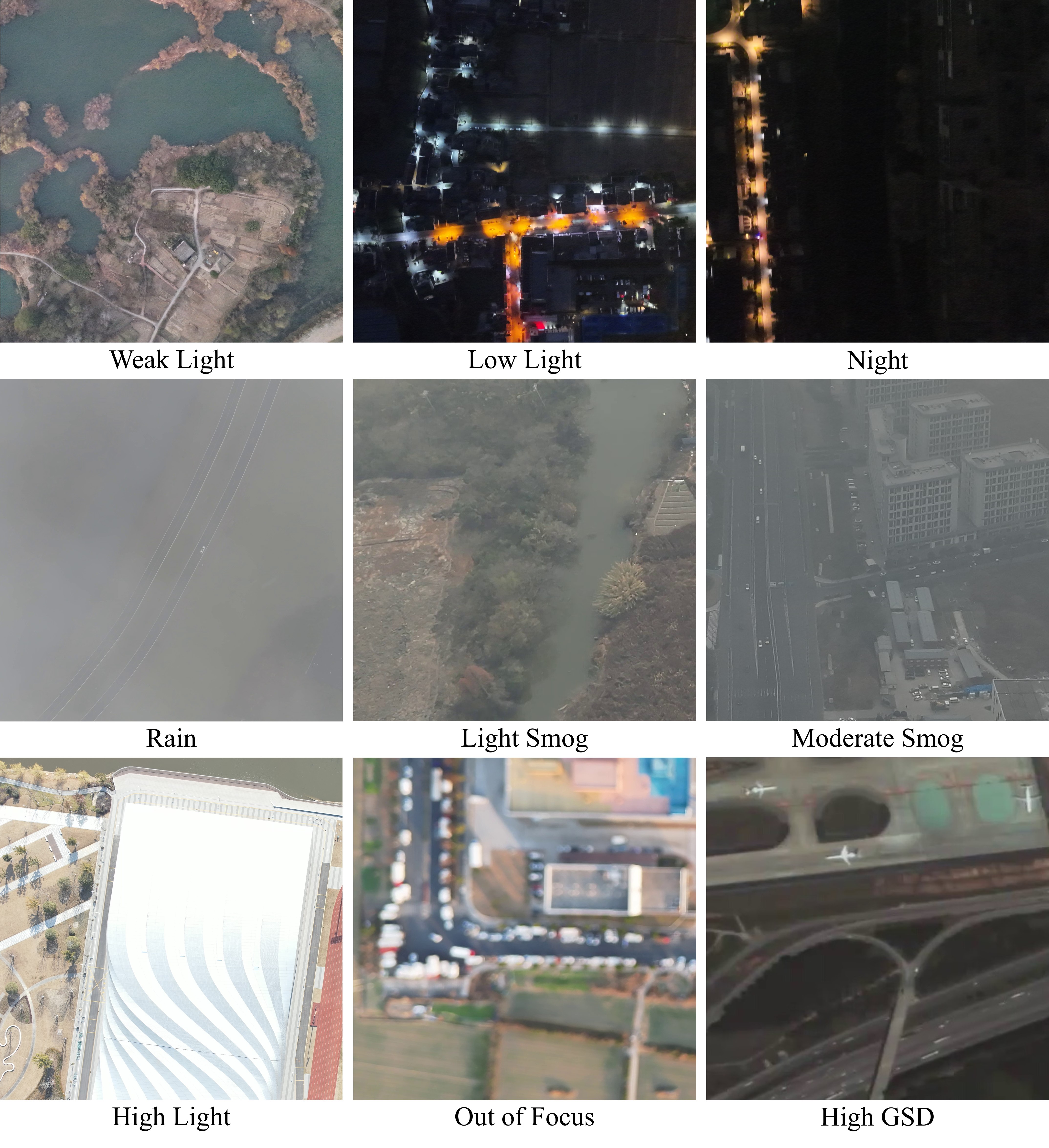
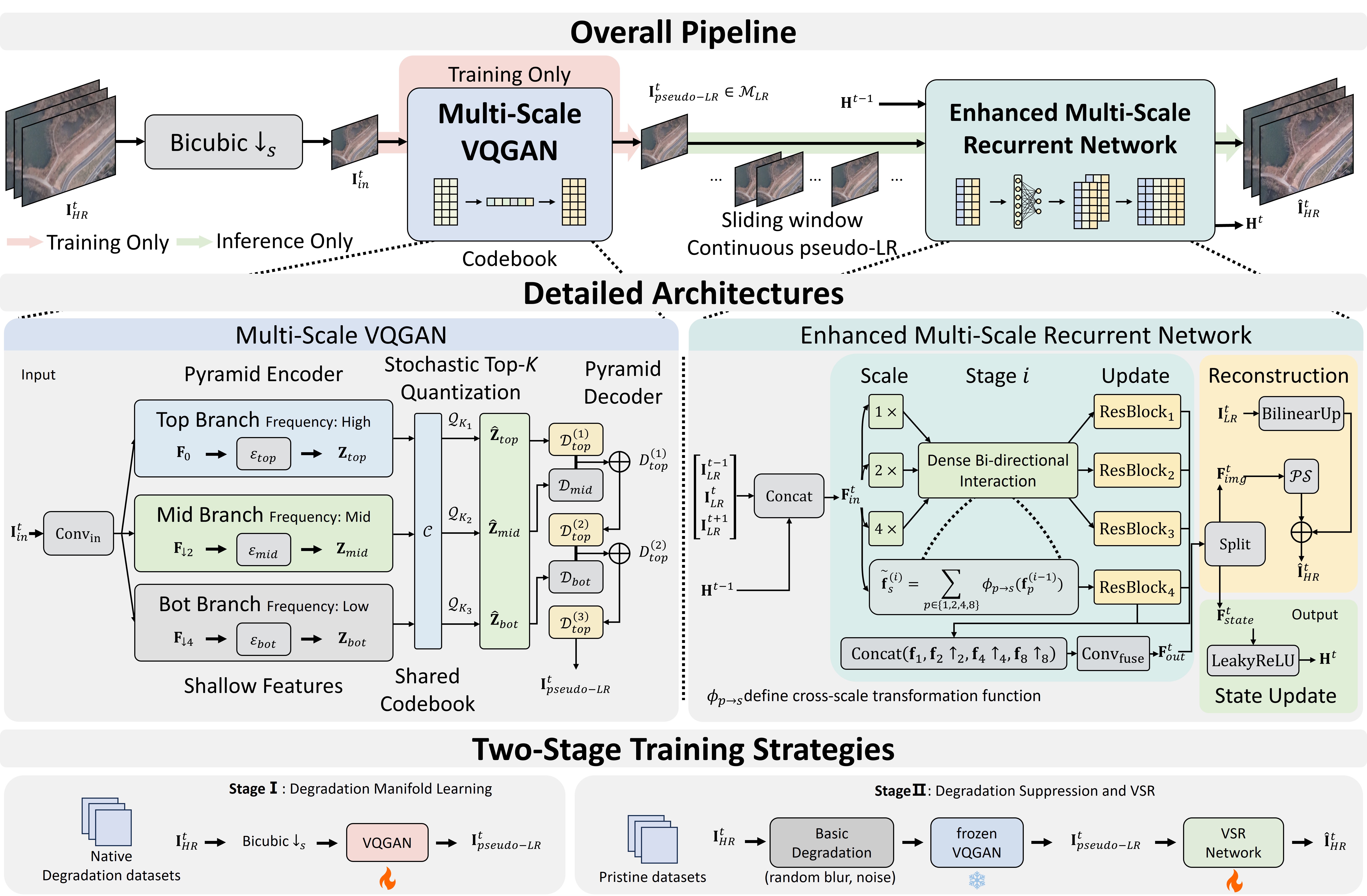
Visual comparison of real-world captures and super-resolution restoration pipelines.
1 School of Astronautics, Beihang University, Beijing, China
2 Tianmushan Laboratory, Beihang University, Hangzhou, China
(* Corresponding author: zhanghaopeng@buaa.edu.cn)
Existing video super-resolution (VSR) algorithms frequently suffer substantial performance drops when deployed on real-world remote sensing scenarios due to the gap between ideal synthetic downsampling and authentic physical degradations. To bridge this critical domain gap, we present TMS-UAV, a large-scale real-world UAV video dataset capturing eight distinct non-ideal degradation conditions across multi-scale environments.
Weak light, low light, night, highlight, rain, light smog, moderate smog, and out-of-focus blur.
Collected using DJI Matrice 350 RTK (Zenmuse P1, 45 MP) and DJI Matrice 4TD (48 MP) platforms at 200–450m altitude.
Over 99,000 frames at 1024×1024 cropped resolution, spanning highways, rivers, campuses, and industrial scenes.
Select a degradation scenario from the left to inspect its video clips, ground sample distance (GSD), environmental parameters, and visual characteristics.
Visual comparison of real-world captures and super-resolution restoration pipelines.
The TMS-UAV dataset is organized into High-Quality (HQ) and Low-Quality (LQ) subsets:
TMS-UAV/
├── HQ_Pristine/          # 180 video clips (81,720 frames, 1024x1024)
│   ├── scene_001/
│   └── ...
└── LQ_Degraded/          # 13 video clips (17,397 frames, 1024x1024)
    ├── Rain/
    ├── Light_Smog/
    ├── Moderate_Smog/
    ├── Weak_Light/
    ├── Low_Light/
    ├── Night/
    ├── Highlight/
    └── Out_of_Focus/
License & Terms of Use: The dataset is released for academic, research, and non-commercial purposes only.
@article{wei2026tmsuav,
  title={Remote Sensing Video Super-Resolution via Various Real-World Degradation Modeling},
  author={Wei, Xiaoyuan and Meng, Fanen and Zhang, Haopeng and Jiang, Zhiguo},
  journal={arXiv preprint},
  year={2026}
}